


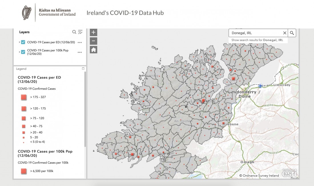


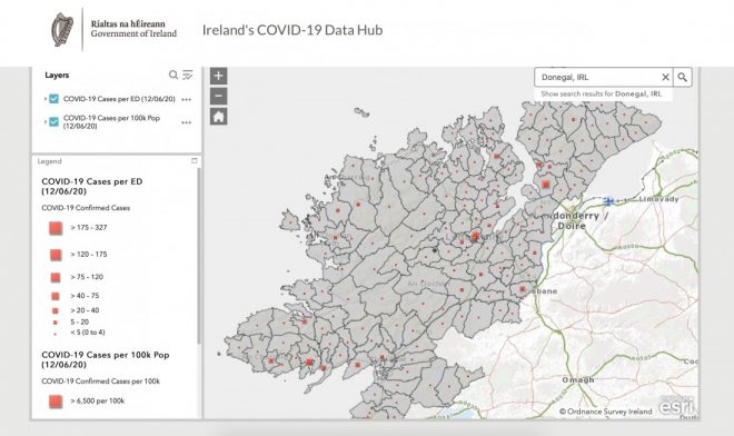
DETAILS on where confirmed Covid-19 cases are located in Donegal are published in a new publicly accessible database on the pandemic outbreak in Ireland.
The updated Covid-19 dashboard shows figures by electoral districts. Donegal has seen just one recorded case of the virus in the past month.
It reveals that Letterkenny Rural, with a population of 11,398 accounted for 45 of Donegal’s 464 confirmed cases with nine each in Letterkenny Urban and Ballymacool.
For confidentiality reasons, exact figures are not published when there are less than five infections in an area.
The map also shows the Ramelton had 7 cases, Castlewray 6 with less than five further round the coast in Rathmullan.
Inishowen was hit hard in the early days of the coronavirus and that’s shown in the figures., Fahan had the highest rate in the county with 33 confirmed cases from a population of 1,697 with 19 in Buncrana Urban and a further 12 in Buncrana Rural. There were six case in Carndonagh.
In south Donegal, Killybegs was another area which recorded a higher rate – 24 cases from a population of 2,293 – which Dunkineely (7) and Kilcar (5).
There were twenty-two cases in Ballyshannon with seven in Bundoran. Donegal town (7), the neighbouring Tantallon (9), Castlefin (5), St Johnston (5), Convoy (8), Glengesh (5) and Stranorlar (5) were other areas at Electoral Division (ED) Level which had five or more confirmed cases across Donegal.
As of June 22, there have been 464 cases of Covid-19 in Donegal since February 29.
Dr Ronan Glynn, Deputy Chief Medical Officer, Department of Health, said the new Covid-19 dashboard was launched on Thursday (June 18) to provide up-to-date information on the key indicators of Covid-19 in the community, including the number of daily cases, deaths, number of people in hospital and ICU and a daily update on testing figures.
He added that it would help communities to be aware of the disease.
“In addition, the dashboard also allows people to monitor the number of cases of Covid-19 in their local area. The management of Covid-19 is an individual task, where we all must remain aware of the disease in our community, follow public health advice and adopt protective behaviours,” he said.
The dashboard is a collaboration between the Department of Health, Ordnance Survey Ireland, the All-Island Research Observatory, HPSC, HSE, and the Central Statistics Office (CSO).
There have been 25,379 confirmed infections and 1,715 deaths in Ireland during the pandemic.
You can search by your address, Eircode or just zone in on the map.
TO SEE THE MAP CLICK https://covid19ireland-geohive.hub.arcgis.com/
Receive quality journalism wherever you are, on any device. Keep up to date from the comfort of your own home with a digital subscription.
Any time | Any place | Anywhere
SUBSCRIBE TO CURRENT EDITION TODAY
and get access to our archive editions dating back to 2007(CLICK ON THE TITLE BELOW TO SUBSCRIBE)