


A new feature on the stories behind old or forgotten buildings, landmarks and places in our community
By Paul Bradley
AT 400 years, the ‘town’ of Letterkenny is not that old, but people have been in the area for longer, largely drawn by the convenience of Lough Swilly (which once extended as far as New Mills).
Archaeological finds (not just in Letterkenny but around the county) suggest a small but sophisticated early population of hunter-gatherers, with farming, megalithic tombs, and metalworking all in place before 500 BCE.
From that point, the area where Letterkenny now stands was part of the Tír Luighdeach, meaning ‘the land of Lughaidh’ referencing the Irish tribe who were dominant there.
In the 13th century the O’Donnell clan, one of the most significant Gaelic ruling families in Ulster, rose to power here. In the process of rising to power, in 1250 CE they overthrew the local ruling chieftains the O’Cannons, the clan who gave their name to the town: the Irish name Leitirceanainn means ‘Hillside of the O’Cannons’, a direct reference to their historical dominance.
The O’Donnells’ own time was limited too, of course. During the massive reordering of land that followed the Flight of the Earls in 1607, the gorsy, wooded lowlands where Letterkenny stands were among numerous areas seized by King James I as part of the Plantation of Ulster.
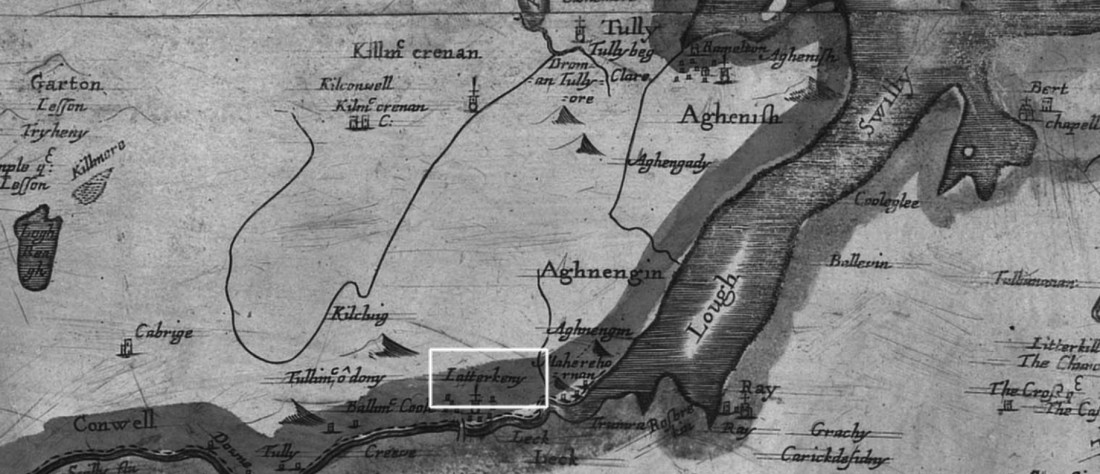
In 1611, James granted approximately 1,000 acres (including the townlands of Leitir Ceanainn, Ballyraine, Sallaghgraine, Gortlee and Glencar) to a Captain Patrick Crawford, on the understanding that he would develop it into a trading stronghold.
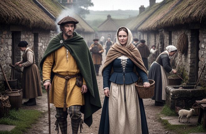
The type of middle class clothing typically worn in a 17th century trading town – like Letterkenny in times gone by.
The area around Letterkenny was a sensible choice: it lay at the first reliable crossing point of the River Swilly, making it crucial at a time when bridges and fords were essential for commerce.
Trade, and the promise of its benefits, were all part of James’ methods for subduing or converting the locals, but conveniently the town was also still close to the ecclesiastical and port centre of Conwal (at that time, Conwal was the important urban centre – Letterkenny would not appear on a map for several decades). As a proposed market town, Letterkenny was planned along the typical Plantation model: a central Market Square surrounded by Main Street, with two main roads radiating outwards (one towards Kilmacrennan, the other toward Ramelton).
James’ award of the land to Crawford was largely a reward for Crawford’s role in suppressing the rebellion of Sir Cahir O’Doherty in 1608, right after the Burning of Derry.
Crawford did set to work on the job of making a town: he commissioned the Oldtown Bridge, for example, and in 1613, Josias Bodley (a military engineer charged with mapping the Ulster terrain) noted at least some initial building and stones gathered for construction.
But Crawford, who remained a soldier, was soon called away again, and was killed in 1615 while trying to suppress another rebellion (this time on the Isle of Islay), and saw little of his project come to fruition.
Responsibility then fell to his widow, Joanna Everard, and her new husband, Sir George Marbury. It was Marbury who, in 1616, secured the Market Patent from the King permitting a weekly market in the town. By 1619, when it was surveyed again, he had built a stone ‘bawne’, (a defensive enclosure – the word comes from the Irish word for ‘cattle-enclosure’) and a town with about 40 timber-framed houses, all inhabited by British tenants. This, really, was the point at which Letterkenny became a proper town, rather than a loose community of people.
There wasn’t much immediate growth in either population or diversity, but it did steadily attract people. One major factor in its early growth appears to have been the Battle of Scariffhollis in 1650: the destruction and bloodshed at Conwal prompted the migration of Irish people into Letterkenny, aiding demographic change and settlement. By 1659, the population was 73, 24 of whom were Irish.
Over the next century the town continued to grow, largely thanks to its status as a market centre; the Civil Survey of 1652-56 offers a glimpse of what it was like at the time: “…a town called Letterkenny which hath a market every Friday and two fairs in the year, with a fair Church and a bridge at the east end over the River Swilly”.
Grand Plantation houses were built at places like Rockhill, Ballymacool, Magherennan and Ballyraine, reflecting both agricultural and trading success.
By the 18th century, the town had grown in size and sophistication, with new structures starting to shape the town into the one we now recognise: Conwal Parish Church was built in 1636, for example, the original Presbyterian Meeting House in 1640 (where the current one now stands), and the Oldtown Bridge (the first stone, and oldest surviving, bridge over the Swilly – the current bridge is not the original, as it was rebuilt a century later using materials from the first bridge) around the same time.
Patrick and Johanna Marbury and the link to royalty
After 1615, George Marbury solidified his position as the ‘top man’ in Letterkenny, gaining an authority that was not completely based on his official status.
He focused on the town’s governance and on making sure the land he inherited continued to meet Plantation requirements. But he was not just a landowner; he was a central legal and administrative figure, with duties including acting as executor for his deceased associates. He was an executor of the will of Sir Richard Hansard, the prominent undertaker of the Lifford estate, something which highlights his standing among the Plantation elite.
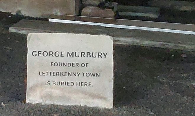
George and Johanna Marbury are buried in the graveyard of Conwal Parish Church in Letterkenny.
Marbury’s influence was not always smooth, however, as evidenced by a gnarly 1625 dispute with the Donegal Provost Marshall Cartwright, where he asserted his authority over the town, freeing people the Marshall jailed (Letterkenny had a slightly Wild West reputation at the time) and insisting that he was the person in charge.
Marbury continued to oversee the town’s development for decades, with his wife Johanna. Johanna (or, more fully, Johanna Everard Baroness Sempill) in fact married four times: to Sir John Marquess of Hamilton before 1604; to Robert Sempill, 4th Lord Sempill, in September 1604; to Captain Patrick Crawford after 1611; and to Sir George Marbury from around 1615.
Kieran Kelly of Letterkenny Historical Society even discovered that Johanna is the 12 times great-grandaunt of Prince William (her first husband, John Hamilton, was the brother of James Hamilton, an ancestor of Lady Diana.)
Both George and Johanna died in 1638 or 1639. They are buried in the graveyard of Conwal Parish Church in Letterkenny.